
The Yacolt ORV trail system is well known among WA residents and is the only 4×4 trail system in Southwestern Washington. It is also in the near vicinity of Jones Creek ORV, which is a group of trails built for dirt biking.
The L-1500 road used to access the Yacolt ORV area is gated on both ends but is usually open year-round. However, it can be closed for various reasons (4×4 trails are sometimes closed from Dec 1 – Apr 30). If you plan to explore this area in winter, be ready to encounter heavy snow and challenging conditions. Also, be mindful that the surrounding areas are used by dirt bikes, hikers, and mountain bikers, which can have intersecting trails.
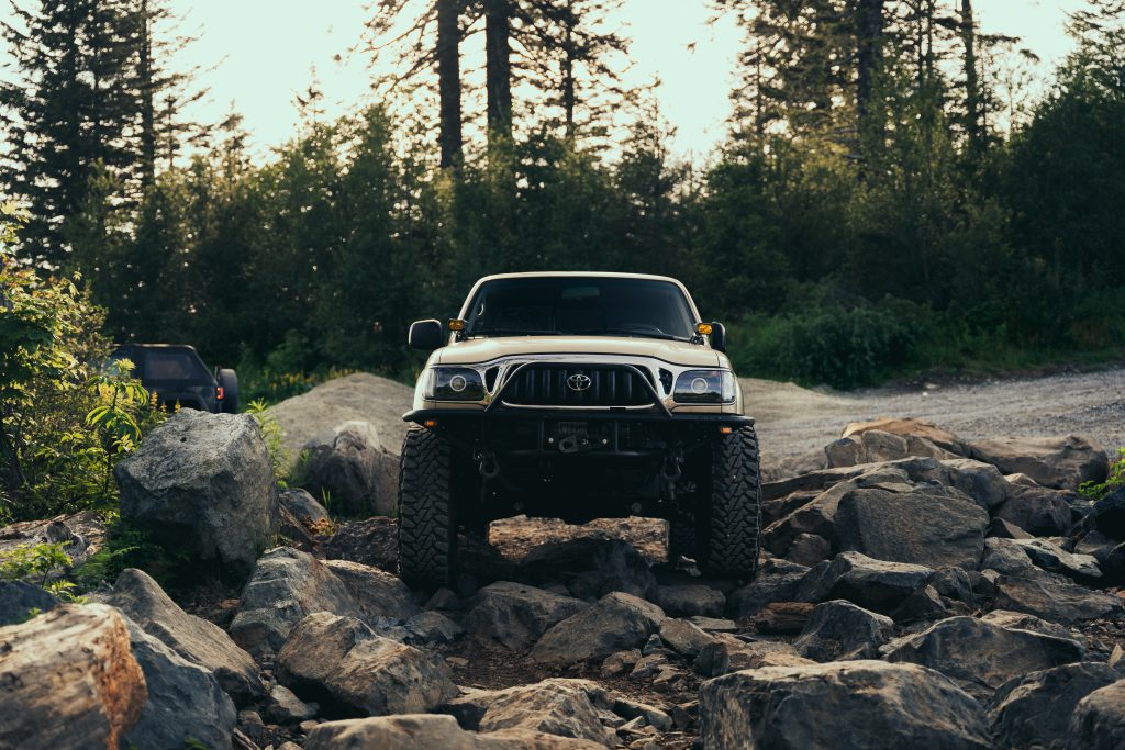
This is an active logging area that combines technical 4×4 trails and rough forest roads, including medium-level difficulty rock crawling. Some trails also branch out into camping areas, interconnections between trail systems, and dead ends with narrow dirt bike trails from there.
Fun Fact: “Yacolt” is a Klickitat word for “haunted place” or “evil spirit”. There are different accounts for how it got this name. A common story is that a group of children were gathering berries there and vanished into thin air. We don’t want you to suffer the same fate, so please pay close attention to all the information below!
Table Of Contents
General Info
Quick Info:
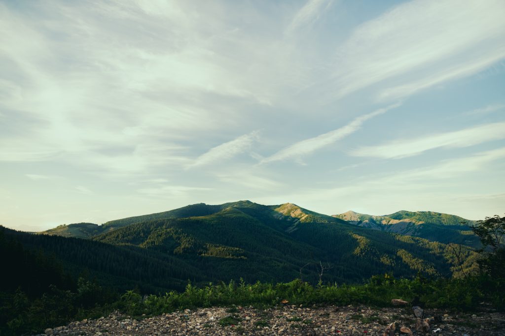
- Location: Just North of Washougal, WA, within the Yacolt Burn State Forest. The area is locally known as the Yacolt Off-Road Vehicle (ORV).
- The main attractions are Mountain View 4×4 Trail, Skyline 4×4 Trail, and the Larch Mountain section.
- Forest Service Road L-1500 is the primary connection in this trail system. It is accessible from multiple entrances. I suggest starting at the Mountain View 4×4 trailhead (45.693981, -122.273586).
- Difficulty (1-10): 3-7 (depending on experience, vehicle, and weather conditions). In winter, expect 3+ feet of snow.
- 4×4 and high clearance with undercarriage armor are strongly recommended
- Approx. Travel Time: Depending on how many trails you explore, roughly 3-6 hours with some stops.
- Governing Authority: Washington state DNR – Pacific Cascades Region. Contact: (360) 577-2025
- Last Fuel Stops: If you are coming from the West (I205 and SR500), the last gas station will be in Mill Plain. If coming from the South or East (SR14), the last gas station will be in Washougal.
- Primitive camping is allowed (except on designated trails).
- Fires are allowed depending on burn restrictions.
The Yacolt ORV trail system opened in 2015 after 8 years of construction and a quarter of a million dollars. It was a partnership between the Washington Department of Natural Resources (DNR) and off-road nonprofit groups. The Pistons Wild 4×4 group and Pacific 4wd Association (PNW4WDA) dedicated thousands of hours and dollars to this trail system and it wouldn’t have been possible without them!
The trails are suited for full-sized 4×4 vehicles but are also marked for multiple use, so expect to see ATVs and dirt bikes.
Trails Overview
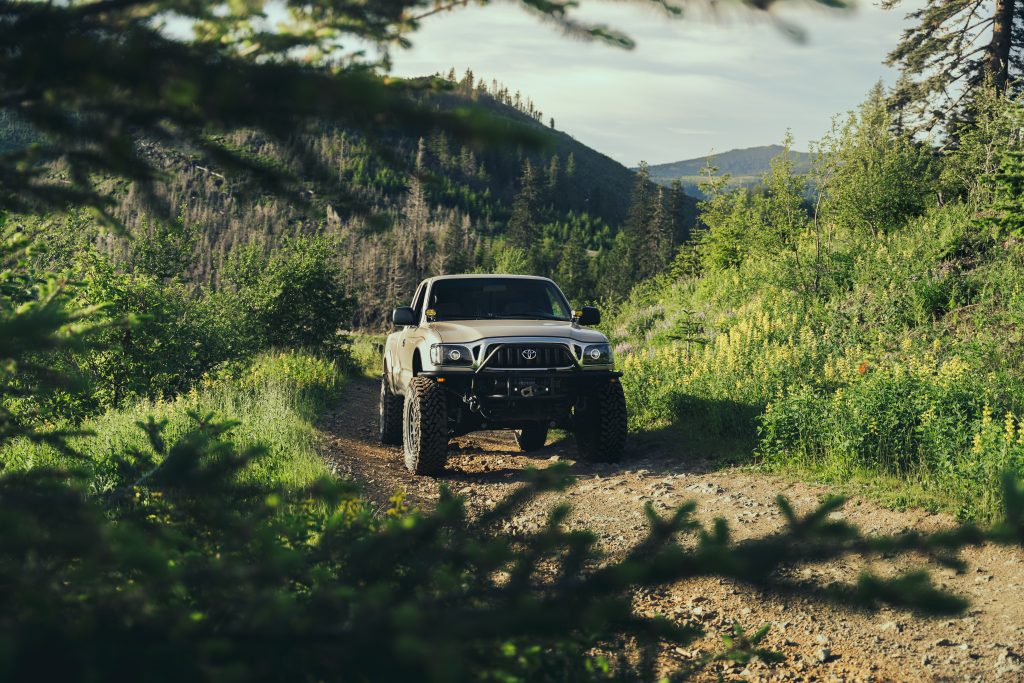
The two main trails in this system are the Skyline and Mountain View 4×4 Trails. Both trails are about a 2-5 on the difficulty scale and are great for beginners. They’re popular destinations because of their insane views and diverse trail conditions. There are sections for absolute beginners, and sections that would present a challenge for experienced off-roaders.
We recommend traveling in a group and having a capable 4×4 vehicle with at least 33” tires and undercarriage armor (depending on how much you love your rig)! These trails are both narrow and twisty. Wider vehicles will have a harder time and may collect scratches from overgrowth. A vehicle width of 70” or less is ideal. My 1st Gen Tacoma handled the trails with no problems, except accidentally ripping out a valve stem on a tree stump!
Both trails are narrow, so abide by off-road etiquette when met with an opposite-direction traveler. While these trails are not as challenging as other Washington ORVs, such as Elbe and Tahuya, they still offer plenty of excitement and beautiful views. Camping is prohibited on these trails, but the nearby areas offer plenty of space.
Who is this area for? From novice to advanced off-roaders looking for trails and spectacular views.
Who is this area not for? A beginner who is traveling solo. The trails aren’t difficult but still present considerable challenges for novice off-roaders. That said, veteran off-roaders with built-out rigs will find that these trails do not offer enough challenge.
Skyline 4×4 Trail
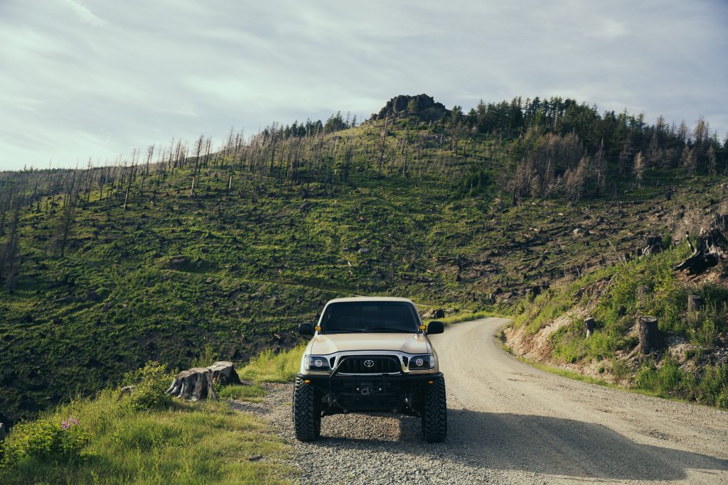
This trail consists of a large loop with multiple branch-offs. Some obstacles include fallen trees, rocky formations, and steep climbs. The entire system is located on the south side of Larch Mountain, offering a great southern view.
The run is about 1.3 miles, excluding forest road sections. This trail is usually closed during the winter with large cement blocks, which is good because it can be impossible to traverse in snow. There is only one entrance for 4×4 vehicles – a sharp turn-off from L-1500 (45.710442, -122.301054). This trail is slightly harder than Mountain View!
Mountain View 4×4 Trail
This trail is one-way, about 1.1 miles long, and twisty and challenging. The entrance is located on L-1520 (45.693917, -122.273493), also marked on maps. There is a rock garden-style gatekeeper to prevent under-equipped vehicles from attempting the trail. This route is mostly forested and has a great view of the valley to the south. It is slightly easier than Skyline but still presents challenges.
Larch Mountain Trails
The third area in the Yacolt ORV system is an unofficial trail section within the Larch Mountains. It is located between Skyline and Mountain View, with a single entrance on Forest Road L-1520 (45.694103, -122.273645), directly across from the Mountain View Trailhead. It combines challenging short trails, camping areas, and shooting pits. This area also has trails that interconnect with the Skyline 4×4 Trail system but are only accessible by dirt bike/UTV.
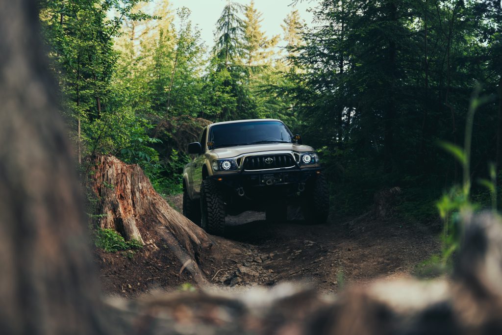
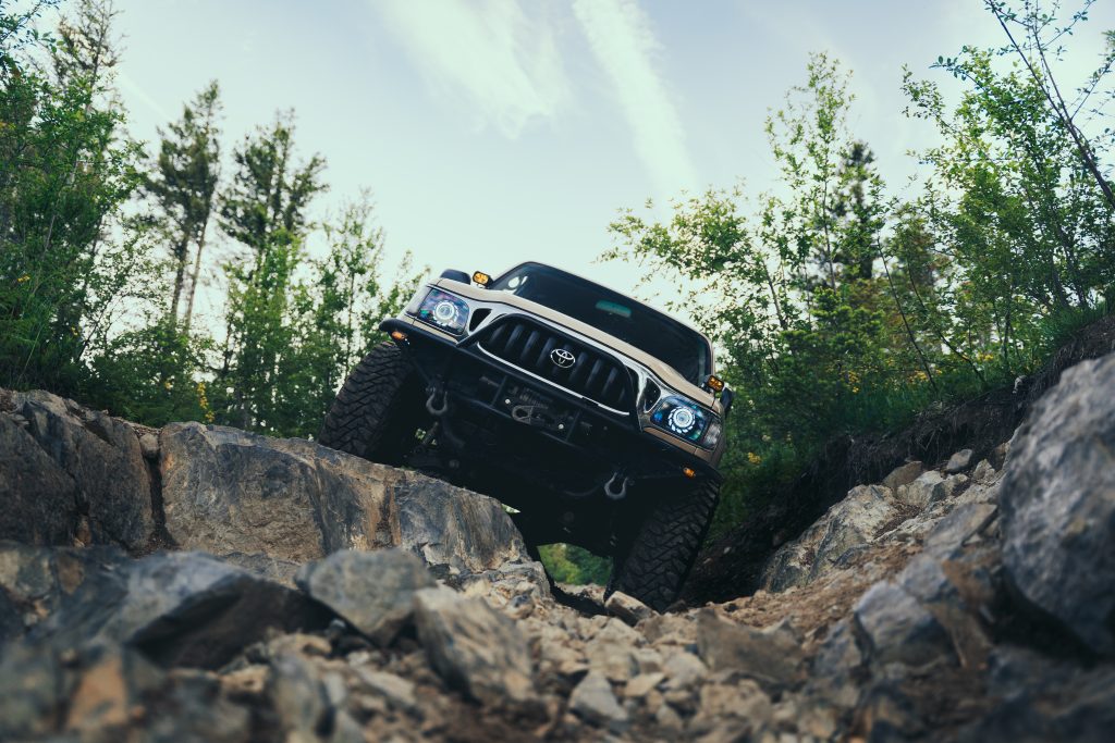
The trails in this area can be harder than Skyline and Mountain View. They incorporate steep hill climbs with large rocks, narrow and overgrown trails, and twisty routes similar to Skyline. Most of them end with scenic dead ends, sometimes on beautiful hilltops. The DNR does not maintain these trails and they are not as popular. They’re better for some off-road fun and camping, though.
It is recommended to have a high clearance 4×4 with at least 33” tires, excellent approach angles, and traction devices. The entire run is about 2.5 miles long and has an elevation change of about 1,000 feet. In snow, this section could be extremely difficult or impossible to traverse, even for veterans. These trails can be closed during winter and times of high fire risk. The entrance is gated, but off-roaders have created their own bypass, which also acts as a gatekeeper.
Who is this section for? Advanced off-roaders seeking harder trails and great camping spots. If you comfortably conquered Skyline or Mountain View, you can give these a try. You can also camp here without touching any hard trails!
Who is this section not for? Beginner off-roaders looking for trails to learn on. The trails are difficult and will present considerable challenges even for some veteran off-roaders. There is also a risk of vehicle damage or rollovers.
Big Rock Viewpoint
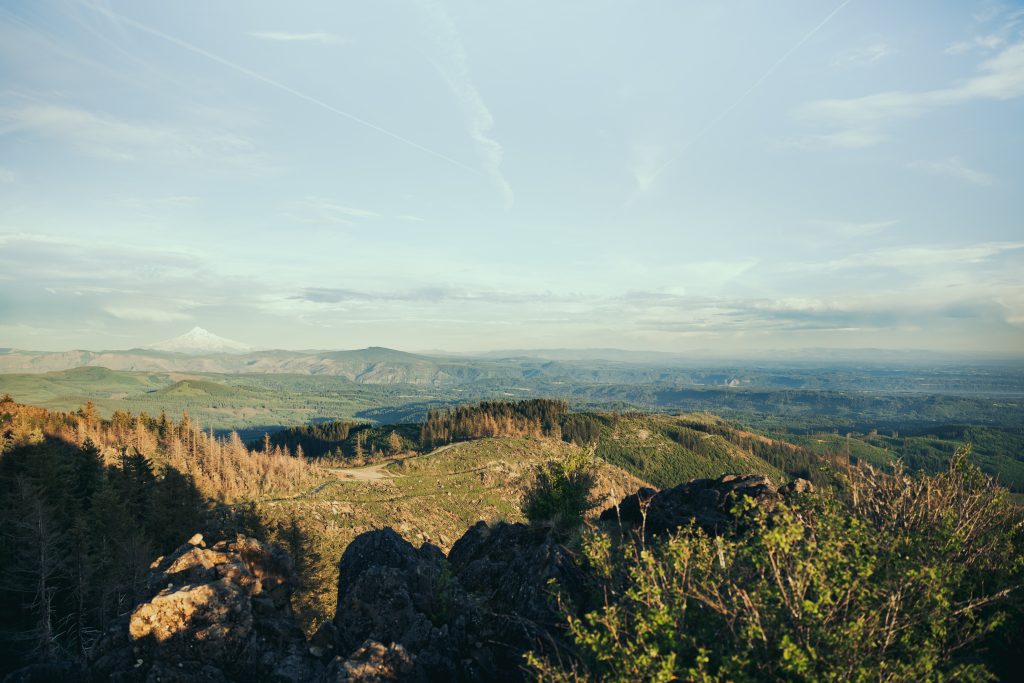
This viewpoint is well known by locals and offers a nearly 360-degree view for 100 miles in every direction. From this rock, you can see Mt. St. Helens, Mt. Hood, Mt. Jefferson, the Coastal Range, and the city of Portland.
The trail up to this point is very difficult and is regarded as the hardest within the Yacolt ORV system. You can also walk to the top if your vehicle is not up to the challenge. The entire trail is only about 1/3 of a mile. Once you reach the top of the initial hill climb, turn left and park next to the large rock. There is room for about 3-4 vehicles max at the top.
The trail does continue into a dead end but gets more difficult and narrow. Camping up at the top is an amazing experience, and well worth the trouble!
How My Tacoma Handled
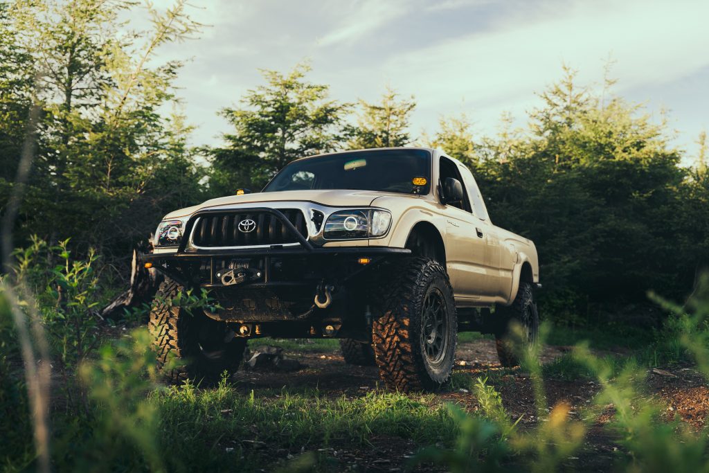
I drive a modified 2001 1st Gen Tacoma. It has the legendary 5VZ-FE engine and a 5-speed manual transmission.
Some of the main modifications include:
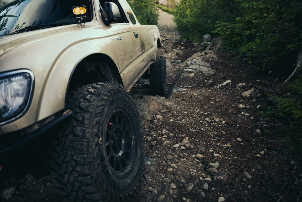
- 2.5” lift
- 34” Yokohama G003 tires
- Method bead grip wheels
- ARB rear locking differential
- Stage II clutch
- Underbody skid plates/armor
I have about 12 inches of ground clearance at the axles and very aggressive approach/departure angles. The Method bead grips let me air down to low PSI levels.
The Skyline and Mountain View trails were no problem for my truck, aside from being a tight squeeze The trails within the Larch Mountain section, however, put up more of a challenge, especially the final stretch up to the Big Rock Viewpoint. I had to be in 4-Lo with my rear locker engaged and tires aired down.
Even with all these mods, I still struggle with some technical parts. I even tore off a valve stem on my wheel, letting out the air uncontrollably. This led me to swap in my full-sized spare on the trail, in the dark. Being prepared is just as important as having a capable vehicle when on these trails. Traveling with a group that has experience is also highly recommended!
Final Thoughts
Yacolt ORV is located within the Yacolt Burn State Forest, named after the dozens of wildfires that ravaged this region in 1902 before there was a systematic way to respond to wildfires.
The entire ORV area is situated atop a 3,500-foot mountain that can offer breathtaking 360° views on nice days. However, the weather in this region is very dynamic, and things can change quickly. Heavy wind, rain, and snow are common and can be treacherous. Always check the weather forecast before venturing to this area and be prepared.
True to its name, fires in this area are still very common during summer and visitors need to take them seriously when camping. Remember to always check for burn restrictions or closures before your trip! With the proper precautions and preparation, this is an amazing area to explore and I highly recommend it.
Have a great expedition!

This area looks beautiful. Exactly what I’m looking for when I say I want to go to the mountains, haha.
What a fantastic article!
This review provides everything I’d need to know with incredible photos included! Thank you!
great job, Shea!
What a great article!! Makes me want to go there now. Thanks for all the descriptions and tips.
Amazing photos! You really capture the place well!