
Whether you’re a local or just visiting, Tincup Pass is a quintessential Colorado experience encompassing the most iconic high country highlights all in one. From historic mining towns to ghost towns, wheelin’ above the tree line, alpine lakes, and crossing the Continental Divide, it leaves nothing to be desired.
Tincup Pass, also called County Road 267, is one of the highest-elevation roads in Colorado. It reaches a peak elevation of 12,154 feet above sea level and was built in 1881 as a wagon road connecting Gunnison County to Chaffee County through the remote Gunnison and San Isabel National Forests. Although it was built for covered wagons, it’s no short trip at nearly 13 miles one-way.
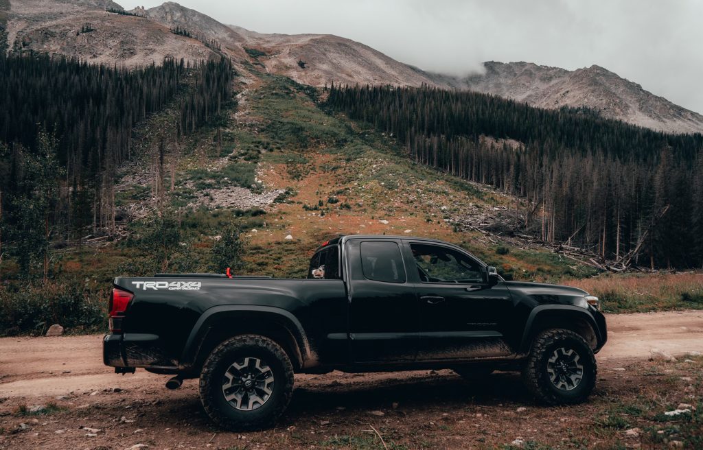
Today, this is a moderate to difficult off-road trail, generally rated 5-6 out of 10 for difficulty on most forums and apps. It’s heavily trafficked by ATVs and UTVs but most high-clearance 4WD vehicles with a low-range gearbox can make the trip. A little extra clearance helps, but a stock Tacoma is more than capable with the correct lines.
Table Of Contents
Getting There From Denver

Trailhead Coordinates (St. Elmo): 38.70374, -106.35003
Getting to the trailhead in St. Elmo takes a 3-hour drive from Denver. The commute back to Denver is about 5 hours from the western end in the town of Tincup or 3 hours from St. Elmo if you come back through.
The route itself from St. Elmo to Tincup takes about 2-3 hours depending on traffic and how often you stop to take in the mind-blowing high alpine scenery. There’s ample opportunity for dispersed camping, making it great for a weekend trip.
I recommend using Gaia GPS, onX Offroad, or a similar app to download a map for offline viewing. There is little to no cell service.
Always check the conditions. This pass is often inaccessible due to feet of compacted snow for 7-9 months out of the year. Traveling from mid-June to mid-September will be your safest bet. Albeit, you can almost always expect to encounter some snow up until mid-July.
St. Elmo To Sawmill Hill (1st Half)

Coming from the East (nearest to Denver), Tincup Pass starts in the historic “ghost town” of St. Elmo. There’s still a small community of residents there and a general store that operates throughout the summer months. So, no, it’s not a true ghost town. However, much of the historic infrastructure and mining history has been preserved.
Important: There’s no fuel in St. Elmo. Fuel up in Nathrop or Buena Vista, off Highway 285, before heading up the mountain to the trailhead.
Staging Area
A small staging area sits at the bottom of the trailhead, but it can only fit a few vehicles at a time. During the summer months, St. Elmo and Tincup Pass are often packed with tourists, hikers, ATVs, UTVs, trucks, and just about anything else you can think of.
On heavy traffic days, use the parking lot on the left at the vault toilets before entering St. Elmo as a staging area. I recommend airing down to 18-22 PSI for this rocky terrain. The sharp rocks don’t let up from beginning to end and you don’t want to end up with a slashed tire.
Trail Conditions
The initial climbs can be managed in 4-Hi but if you don’t want to battle with keeping traction, 4-Lo makes the steep crawl up loose rocks much less labor-intensive. The staging area at the start is a good place to lock in 4-Lo before things get steep.
This iconic Colorado route begins with a sharp, rocky climb. It’s a bumpy, teeth-rattling ride all the way through, so be prepared for that. The first half presents much of the same as you’ll encounter in the initial climb; steep climbs over loose rock followed by smoother, flatter dirt and gravel roads punctuated by astounding views, photo ops, and more rocky climbs.
The climbs are slow-going and there’s often quite a bit of traffic coming from both directions. This one is popular among hardcore 4×4 enthusiasts (for good reason!). Fortunately, there’s room to pull over at the bottom of most of the climbs.
After the first couple of miles, the trail gets a little more dicey, but it’s nothing a stock Tacoma can’t handle. This section presents a couple of sharp turns on narrow, rocky roads. My long bed Tacoma had just enough space to eke out these turns without having to make difficult technical maneuvers in reverse. Watch the traffic carefully because these areas can become a chaotic mess at times.
After much climbing and crawling up and over a few tall rock ledges and ruts that max out at about 12-14 inches in height and depth. This is variable depending on how snow and rain conditions have been. You’ll reach a right turn off towards Sawmill Hill, stay straight. This is roughly the midway marker.
Camping
There are campsites, creeks, and hiking spots that split off on the left along the first mile. If you plan on camping, I recommend one of these spots or near Mirror Lake (keep reading).
Sawmill Hill To Mirror Lake (2nd Half)

To embark on the second half, pass the turn for Sawmill Hill and continue climbing in elevation. There are a few steep, narrow switchbacks on shelf roads that can remain snow-covered until as late as July. They can be a bit heady but aren’t too bad compared to other cliffsides that many of Colorado’s off-road trails track along. Following the switchbacks, Tincup Pass rises to its peak elevation just below 12,200 feet above sea level.
Descent
After reaching the summit, begins a gradual descent — albeit peppered with more deep drop-offs and ruts. One of which tried to flatten my exhaust. The departure angle on a stock Tacoma is just enough to safely descend the obstacles. Going slow and placing your tires with intention is key to not smacking your rear.
There’s one more fork in the road before Mirror Lake. The left and right fork both meet up in the same place, stay left. The right side takes you along the old Tincup Pass Jeep Trail. It’s far more narrow and technical and I can’t say whether or not a stock Tacoma would make it.
Mirror Lake
Mirror Lake is the next waypoint. Schedule some time to spend here for a snack or to snap some photos of this gorgeous alpine lake. There’s also plenty of room for parking and dispersed campsites around it. During the summer, there’s a lot of competition vying for these prime locations.
The conditions near Mirror Lake are often pretty low-key, but in late spring, there can be water crossings up to two feet deep in this area.
Leaving Mirror Lake puts you on the final stretch towards Tincup. The trail will gradually drift left with a few turnoffs to the right. Stay left.
Tin Cup

The descent into Tincup is the most challenging part. It’s steep with large sharp rocks and some serious drop-offs. The far left side is the most tame, but choose your line carefully. With 4-Lo and MTS activated (if equipped), the steep, slick decline is manageable. There’s plenty of potential to scrape or ding up your frame here.
Once you’ve finessed the descent, you’ve made it! This is a long one and can be made to feel even longer for passengers due to the rough ride. However, every mile rewards the journey. Tincup Pass is packed full of adventure and iconic scenery, and it’s enough of a challenge to keep the drive fun and engaging for all experience levels.
Final Thoughts

After landing in Tincup, there are plenty more trails to explore if you choose to do so; adventuring to Pitkin via Cumberland Pass, and Pitkin back to St. Elmo via Hancock Pass make for an epic adventure along the Miner’s Loop. Note that Hancock Pass is more difficult than Tincup.
If you prefer to head back on a paved road, Cottonwood Pass takes you on a scenic drive back to Buena Vista.
Whichever route you choose, if you’re on the hunt for an iconic off-road adventure in the Colorado Rockies, Tincup Pass won’t steer you wrong (pun intended).
This trail looks beautiful! Those camping spots and lake really caught my eye. I’ll have to check this one out myself.